City Centre Inside Inner Ring Road
Note that you can click on any old picture to see a larger version
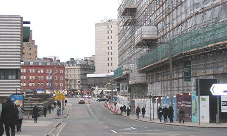
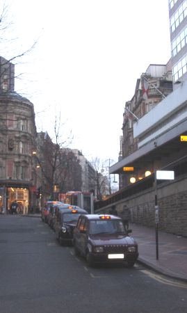
Hill St
|
|
 |
 |
| 1963 |
2005 |
| These
pictures show nothing in common but the road layout. Just beyond
the bus in the 1963 photo, the building with the Ansells sign was the
Golden Eagle pub. This lasted well into the 1970's as my brother
used to meet his girlfriend (now wife) there. The church like
building to the left of centre was Queens College Chambers. The front
of this building can still be seen in Paradise Street today and
is very attractive. Also on the 1963 picture you can see some cobblestones just behind the pedestrians on the right hand side of the picture. My theory is that this is the entrance to Queens Drive and thus New St Station. |
|
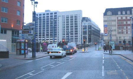
Stephenson Buildings
|
|
 |
 |
| 1961 |
2005 |
| Here's a
splendid survivor! Actually, plenty did survive the redevelopment
with Corporation Street and Colmore Row being good examples of how
Birmingham would look today if things had been different. With central heating installed I guess there was no need for Stephenson Building's fine chimneys - just something else to maintain but it does look somehow less impressive for their loss. Note that many of the buildings in the background of the 1961 picture have been replaced in 2005. |
|
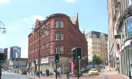
Stephenson Place
|
|
 |
 |
| 1962 |
2005 |
| This
picture depressed me. Just look at the magnificent building on
the right in 1962! It was the Birmingham Exchange, opened in 1865
primarily as a commodity exchange for iron and steel. And what do
we have in its place in
2005? The concrete ramp to the Pallasades shopping centre. |
|
Colmore Row Nr Council House
|
|
 |
 |
| 1962 |
2005 |
| As I
mentioned above, Colmore Row is part of the city that has kept much of
it's character. Away from the ring road and the main shopping
area of the city it was safe from the bulldozers. Well, as you
can see - almost safe. Actually the buildings on the right of the
1962 picture were demolished so that Victoria Square could be
extended. It's now a meeting place for Birmingham's citizens and
provides a good, clear view of the superb, Victorian
Council House. |
|
Colmore Row Nr Newhall St |
|
 |
 |
| 1962 |
2005 |
| Again,
another indication that Colmore Row was left alone during the
redevelopment of the 1960's. What's most striking about the 1962
picture is the road sign on the right hand side. 5 'A' roads of
traffic going down Colmore Row! I suspect traffic for the A41 and
A34 would have then gone all the way down New Street before heading
down High Street, Bull Ring and Digbeth. Traffic for the A38 and
A456 would have gone up Congreve Street which can be seen on the Inner Ring Road North page. In the 2005 picture, Birmingham's historic Town Hall (opened in 1834) is undergoing long overdue repairs and refurbishment. It was closed in 1996 due to health and safety reasons. It can be seen shrouded in plastic as the works continue. |
|
Dale End / Bull St / High St
|
|
 |
 |
| 1962 |
2005 |
| This
picture blew me away. When I read the note on the back I still
couldn't relate it to the city I knew. Dale End, Bull St and High
St are not the nicest part of the city centre today but in 1962 it
looks amazing. Shops and streets full of character - just look at
the curved frontage of the Preedy's shop in the centre of the
picture! As mentioned on the Inner Ring Road Central
page,
Dale End is now, in my view, the ugly backwater of the city centre. The building on the left of both pictures proves that really is the same place, however hard to believe that may be... |
|
High St / Carrs Lane
|
|
 |
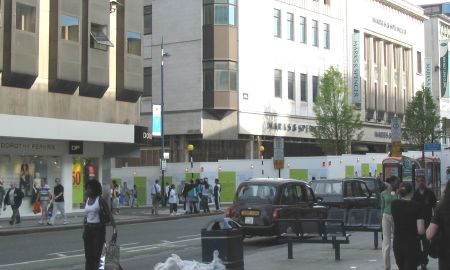 |
| 1953 |
2005 |
| The city
may change but the shops don't seem to. In 1953 you can see both
Dorothy Perkins and Marks and Spencers. In 2005 both shops can
still be seen but in different locations. What happened to Jays
and Allans though, I would not like to speculate. Interesting to see that a pedestrian crossing has existed at the junction of Carrs Lane and High Street for over 50 years at least. I would say you'll never see a tram coming out of Carrs Lane again but with the proposed introduction of a second Midland Metro route along Broad Street - who knows what the future may bring? |
|
 |
 |