Clee Hill Incline
This group of slides really caught my attention. They provide a
rare glimpse of an historic, industrial railway system that has long
since disappeared.I have been unable to find much information about the Clee Hill incline railway on the internet. In fact, the most useful information came from a rather odd source. The "Geological Trail for Titterstone Clee and Clee Hill" (1.1 Mb PDF) produced by the Shropshire Geological Society contains some useful facts and some further pictures, one of which captures the same location that my father visited (see page 13). It tells us that the Ludlow and Clee Hill Railway operated from 1864 until 1960 and the 1 in 9.27 cable-operated incline was the longest in the country coming in at 1988 yards.
In August 2007 I visited the site of the railway and I have to say it was a fascinating experience. Although much of what is shown below is now long gone, what remains combined with the record created by my father's pictures helps bring this historic railway back to life. If you decide to visit then make sure you also drive to the summit where the remains of the mine workings at the top of the Titterstone Incline are even more spectacular! Have a look at this panoramic shot to get some idea.
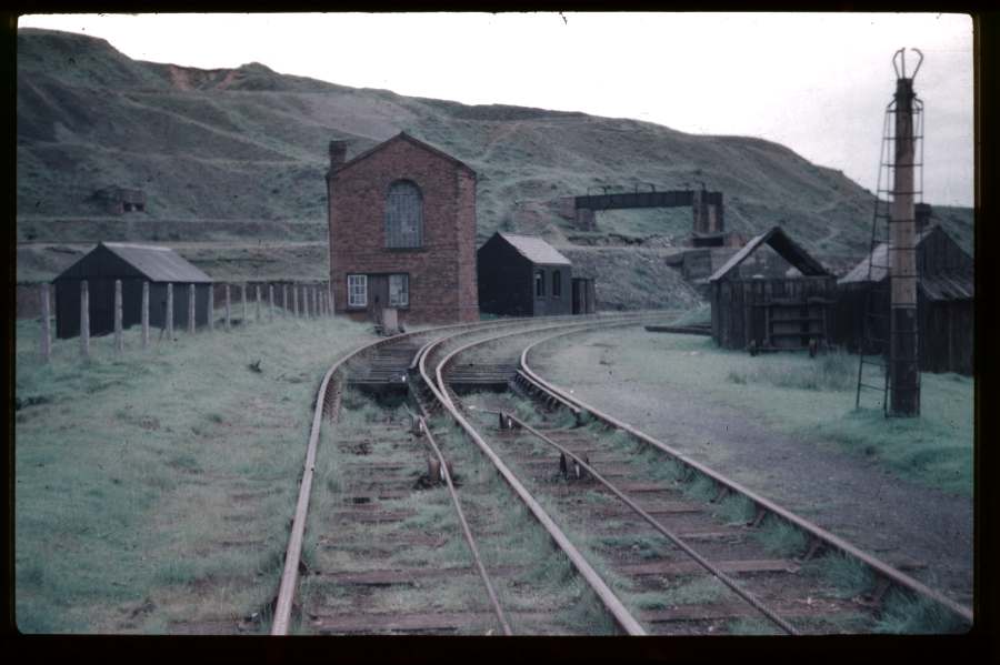
Shed Clee Hill - 26/6/55
|
|
|
|
| A rather inauspicious
start. I suspect this shed was located at the top of the incline
where the quarried rock would be transferred onto regular goods wagons
for transfer to Ludlow. Michael got in touch with the following information: "The 'shed' you refer to in the top picture was actually the engine shed! A single loco (a Sentinel in the 1950s; 47183 was there in 1955 and 47181 in 1956) was shedded there. You can see on the left the wooden stanchions to prevent the wind blowing it over! Sensibly, the coal stage was inside (an unusual arrangement)." |
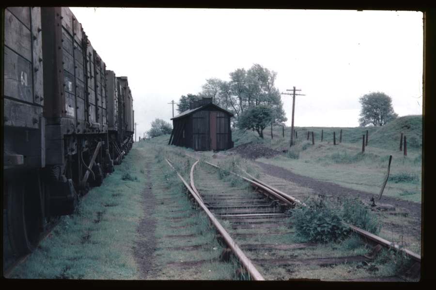
Top of Clee Hill Incline - 26/6/55
|
|
|
|
| This is more
like it! Note that there are only 3 rails so I wondered how
wagons could pass each other. Thanks to Steve for letting me know
that there would have been a passing loop further down the incline and
for pointing me at a picture of the
Corkickle Incline. The "Geological Trail for Titterstone Clee and Clee Hill" says that the road bridge carries Summit Road but my research suggested that it was Dhustone Lane which is a right turn off the Ludlow Road after passing through Clee Hill village en route to Ludlow. My site visit proved my theory and I took this picture which shows the house to the left and the bank to the right. All signs of the railway have gone, the bridge has been replaced by an earth bank and a chicken run is now where the rails once were... This picture was taken from NGR SO587761 looking west-north-west. |
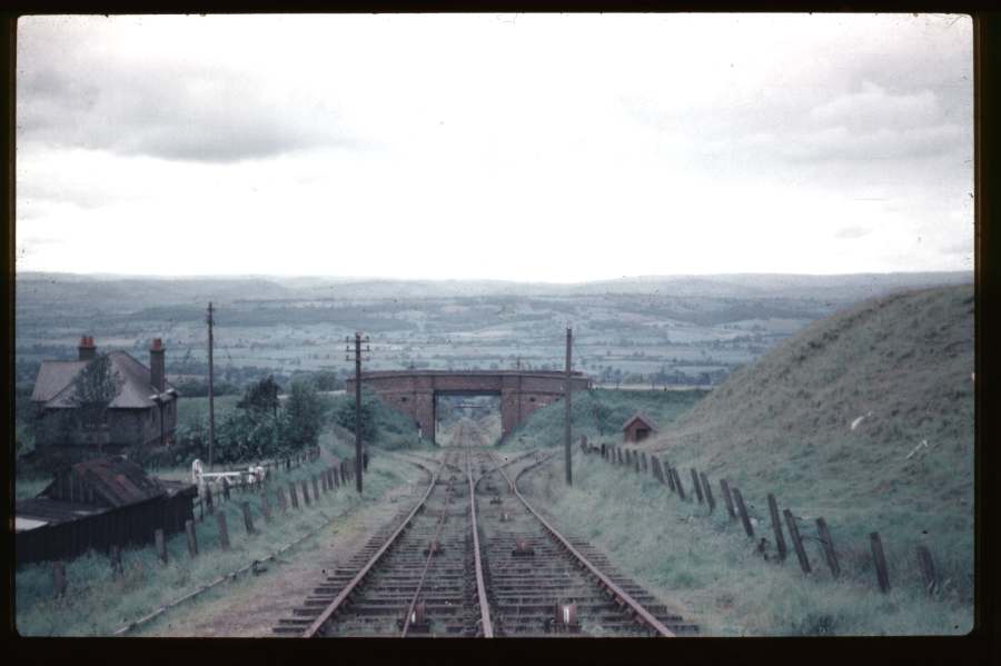
Clee Hill No 3 - 26/6/55
|
||
|
||
| Having walked a little further
up the hill from the location above (you can see the road bridge
through the gate in the lower shot), these two pictures show a side and
front view of one of the cable hauled wagons. The wagon is
marked,
"Clee Hill Incline No.3". I wonder how old it was when this
picture was taken? Is the little shed visible in both shots a workers W.C.? Imagine how cold that would be on a winters day! During my site visit I was delighted to see all the Victorian cottages still in place, including their impressive chimneys. Although the W.C. has gone, the building to the right of the upper shot remains as my modern view of that picture shows. |


Winding Hse Clee Hill - 26/6/55
|
|
|
|
| At the top
of the hill this fine Victorian winding house was located. Note
the cables disappearing under the track as the rails curve off to the
right. Can anyone explain the purpose of the rather odd pole to
the right of this shot? Note the strange 'grabber' arrangement on
the top. I wasn't suprised that the engine house had gone when I visited the site but a lot of the concrete based infrastructure remains. This picture shows the scene above 52 years on. The remains of the winding house seemed to be buried in the hump to the right of my picture as I found bricks and slate poking out. I also found an interesting brick lined trench that may well have been where the cable passed under the track in the picture above. |
 |
 |