Halesowen
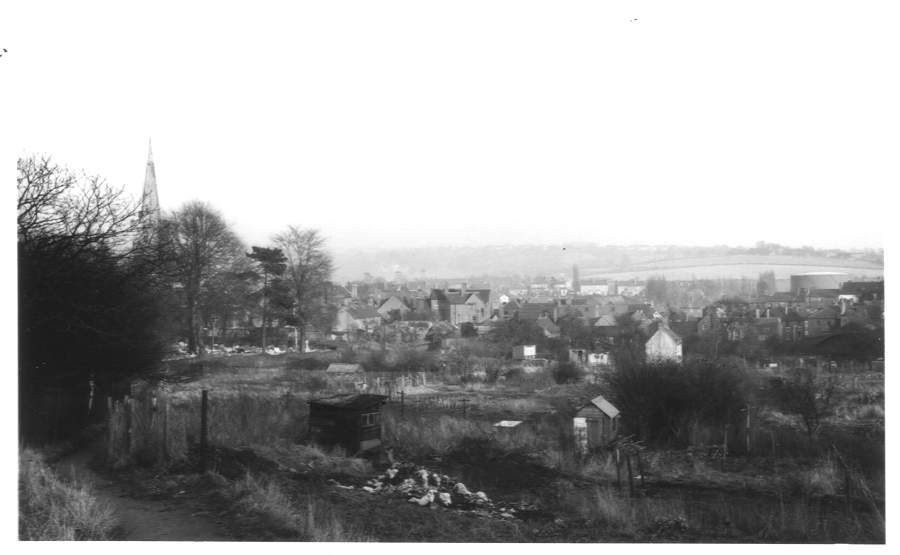
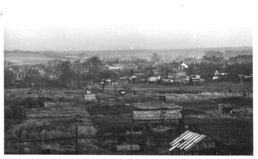
Halesowen Allotments - 29/1/56 |
||
|
||
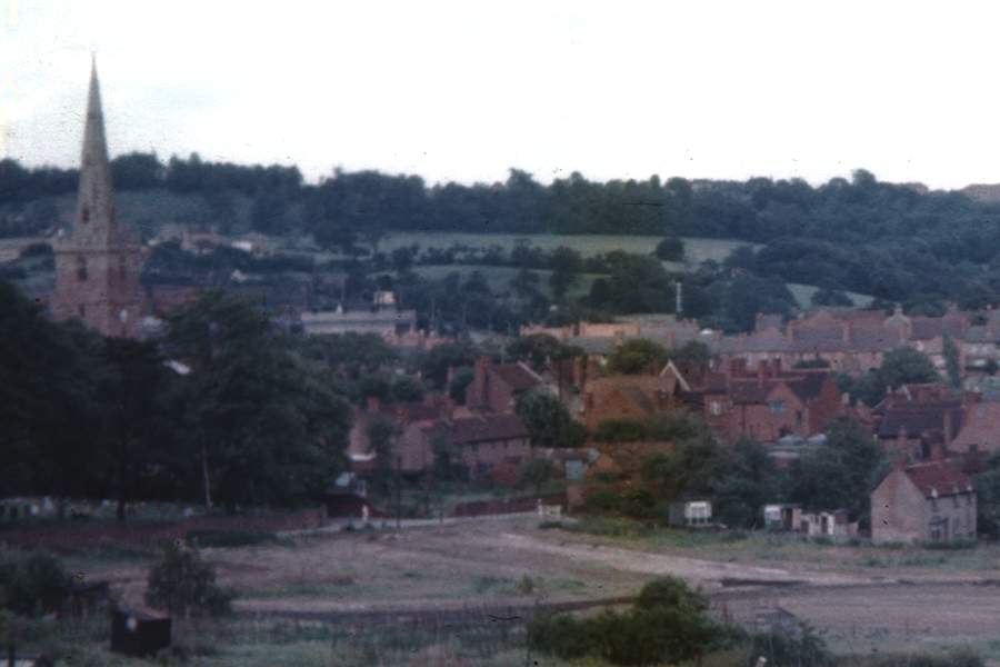
| These two pictures of the
allotments at Halesowen were taken by my father's friend, Ken Morris,
who lived in the town. Ken obviously knew that the allotment's
days were numbered and the shops we now know as the Cornbow
Centre would shortly replace them. The pictures actually form a kind of panorama. The left hand side of the top picture shows St John the Baptist church, a common reference point on many of the pictures below. To the right there is a gasometer and this features on the left hand side of the lower picture. |
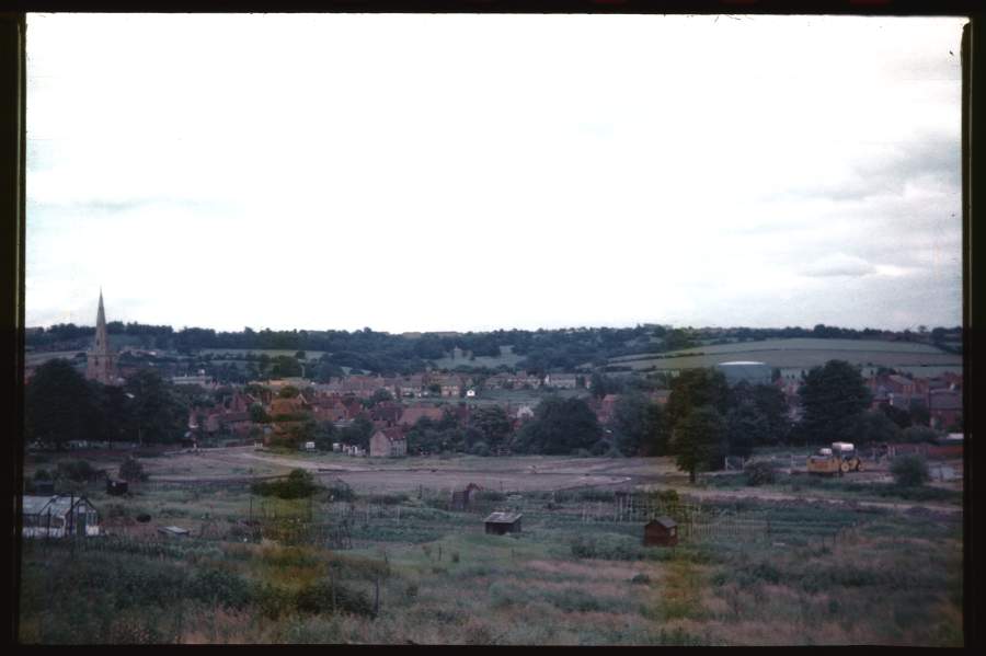
Site of New Shops, Halesowen - 8/7/56 |
|
|
|
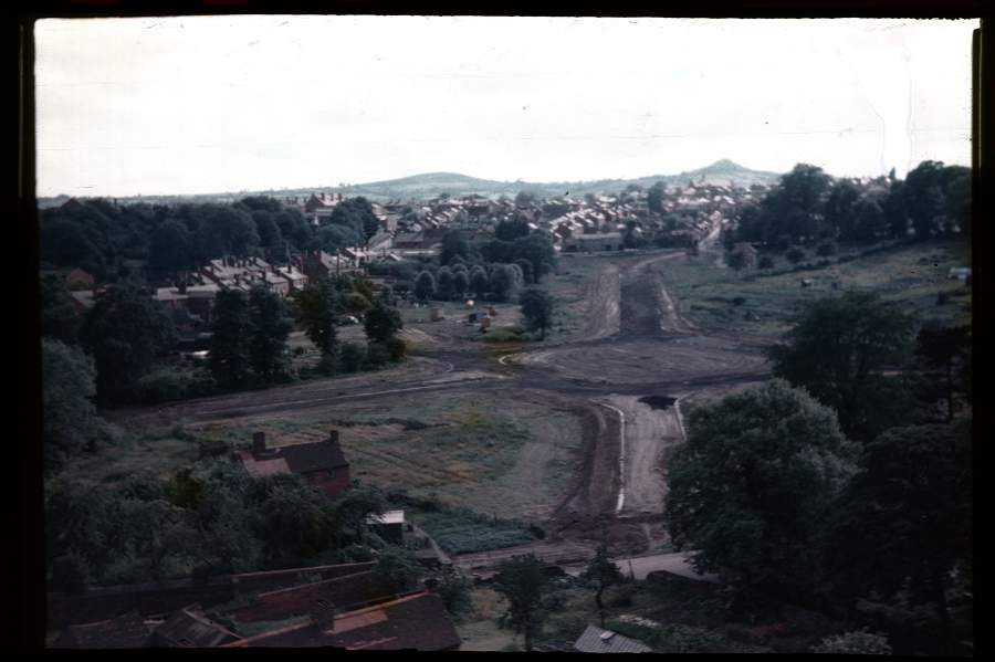
| Now this
picture has got me thinking... Was the redevelopment of Halesowen
the trigger of my father's interest in recording changes such as those
of Birmingham that commenced shortly
afterwards? If so, given the pictures taken by Ken above, maybe
it's Ken we have to thank for giving him the idea! Less than 6 months after Ken was recording the scene, work had commenced. To the right of the picture, you can see some of the yellow construction vehicles. |
Site of New Shops, Halesowen (Close up) - 8/7/56 |
|
|
|
| When zooming
in on the picture above, I was taken by this section of the town, close
to the church. It looks like the idylic English village scene. |
Site of New Shops, Halesowen, from Church - 8/7/56 |
|
|
|
| OK, so how
did my father get to climb the church tower for this picture!?
Thankfully, my mother came up with an explanation. Apparently,
Ken's father was the verger at the church. Just goes to show it's
not what you know, it's who you know... The view is, I believe, looking towards the south east so the hills in the distance could well be Clent. Note the remnants of the allotments to the right. |
N View, Halesowen, from Church - 8/7/56 |
|
|
|
| Now this one
had me confused for a bit. A north view would surely be towards
Furnace Lane but none of the buildings fitted in with that.
Thankfully, the ever useful Google
Maps helped solve this one as the two, large houses with double
height bays seen on the right are still standing and are located in
Whitehall Drive. That makes the road that the Midland Red bus is
about to head down Rumbow. So, a more accurate description would
be that the view was towards the north east. |
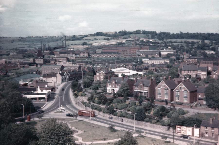
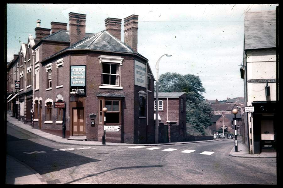
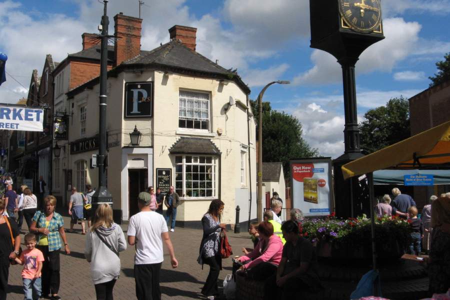
Birmingham St, Halesowen - 8/7/56 & 25/8/12
|
||
|
||
| I don't
normally display pictures like this on the site but I wanted the two
large pictures to be together to just see how dramatic the change
is! It's hard to believe that the A456 to Birmingham used to run
where people now rest on benches slap bang in the middle of the town. It's a shame that the attractive Lyttleton Arms has become the neglected Picks as I think it looked much better in red brick rather than painted. Note how it has lost one of its chimeys too. |
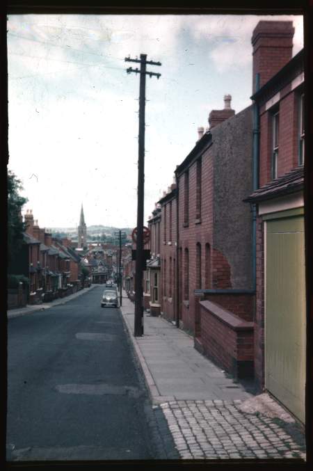
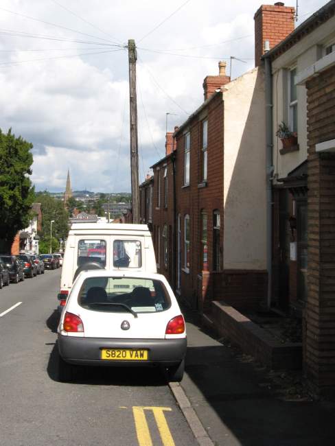
Summer Hill, Halesowen - 8/7/56
|
||
|
||
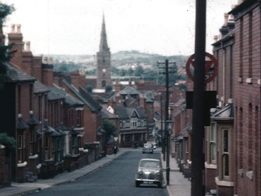
| The last
view my father took on his visit in July 1956 is looking down Summer
Hill to the town centre. My view, taken 56 years later, shows how
cars have overrun streets like this - what a difference! A close
up of the centre section of my father's picture is shown below. |
||
 |
If you remember Halesowen Railway station, you should check out the Halesowen Railway pages!
 |
 |